Flood Control Infrastructure and ‘Political Hydrology’ along the LA-TX Gulf Coast
The nation’s costliest natural disasters continue to be caused by flooding. Every year, with enormous personal and financial cost to U.S. citizens, floods damage crops, infrastructure, businesses, personal property and, most unfortunately, cost American lives.1 Americans are quick to forget such disasters, however, in part because they’re frequently popping up in other places. Remember the devastating flooding in south Louisiana in August 2016? It cost $10.0 billion. Other than Texans and Oklahomans, most Americans probably do not recall their floods way back in May 2015. It cost a mere $2.6 billion.1 And these are just a couple of examples. The single event we have not forgotten, thankfully, is the 2005 Hurricanes Katrina-Rita flooding of New Orleans and the Gulf Coast. It cost $153.0 billion, the most expensive flood disaster in the U.S. Of course, this was until Hurricane Harvey struck the Texas and Louisiana Gulf Coast. Cost are still being tallied, but unofficial estimates of flood damage cost associated with Hurricane Harvey range from $150 to $240 billion.
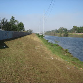
A sure way to reduce annual flood cost and protect the financial and personal livelihoods of Americans residing in flood prone regions is to strengthen America’s levees, an enormous system of flood control infrastructure.2 This means fortifying, heightening, and/or moving levees away from the river. These options, especially the latter, are in accord with “integrated flood management,” which has become the status quo in Europe.3, 4 In the Netherlands this approach is known as making “Room for the River.”4
Flood control in the U.S. is long entrenched in the paradigm of the “100-year” flood (i.e., 1 percent event), a strict probabilistic approach rooted in a decades old practice from the late 1960s that was advocated by insurance agencies and based on shaky assumptions regarding statistics, climate, and land use.5 A 100- year flood event may seem unlikely to occur during any given year, but it has a 26 percent chance of occurring in the life of a typical 30-year home mortgage. These are not favorable odds, and they’re even less favorable in view of documented historic (recorded) climate change, land use change, and land subsidence that has occurred since the 1950s.
Change had come to America, at least it seemed. With an inability of Congress to pass climate proof flood policy, action occurred at the executive branch. President Obama’s Executive Order 13690 (Establishing a Federal Flood Risk Management Standard and a Process for Further Soliciting and Considering Stakeholder Input) (6), anchored with an extensive synthesis of floodplain science research, included many tenants of “integrated flood management” with similarities to those already practiced in Europe.3, 4 In particular, EO 13690 explicitly required up to date scientific climate change projections to be included in the design of flood control infrastructure as well as embracing a modern “flood risk” approach that takes into account human safety and the value of human activities (e.g., industry, property values, agriculture, etc…). This is broadly in agreement with the direction advocated by the nation’s highest body of science, the National Academies of Science. Specifically, EO 13690 provided three options for redesigning federal flood control levees, including i) utilizing the best “actionable” climate change science, ii) construct levees two or three feet higher than the elevation of the standard 100-year recurrence interval flood, or iii) design levees to the standard of a 500-year flood recurrence interval (in the Netherlands federal levees are designed to withstand flood events having a flood recurrence interval of 1,250 to 10,000 years). An additional key component of EO 13690 is that it recognizes the value of “working with nature” to reduce flood risks, which supports environmental conservation and restoration of valuable floodplain wetlands and associated ecosystem services. This is especially important along the Gulf Coast and the lower Mississippi River because the storage of flood waters on the floodplain increases nutrient sequestration, such as phosphorus and nitrogen, which are associated with the Gulf of Mexico Dead Zone, an enormous seasonally occurring area of hypoxic (oxygen poor) water off the coast of Louisiana and Texas detrimental to the shallow marine ecosystem. Thus, EO 13690 in essence represented a change from flood control to flood management. The intended move towards this “integrative” approach to flood management was not just substantial, it represented a paradigm change in the vision and mechanics of U.S. flood control that was also environmentally friendly. And, as levees are the embodiment of flood control infrastructure, implementation of EO 13690 is squarely in accord with President Trump’s stated intentions to improve the nation’s infrastructure.
Implementation of EO 13690 required stakeholders, such as states and levee boards, to develop a plan based on one of the three above approaches in coordination with federal agencies (e.g., FEMA, Federal Interagency Floodplain Management Task Force, Water Resources Council, etc.). Thus, local and state governmental institutions had several options that enabled them to alter the placement of levee systems in accord with their own priorities, such as nature preservation, agriculture, cultural heritage preservation, and urbanization.7 Implementation of EO 13690 would have seen the U.S. finally moving forward with adaptation of a modern “integrated” risk based approach to flood management that enhanced floodplain ecosystems as well as respecting up-to-date climate change that impacts flooding in America.
Predictably, EO 13690 was abruptly challenged by some stakeholders, including those who are arguably in most need of reduced flood risk. The Association of Louisiana Levee Boards (representing all levee boards within the state of Louisiana) was opposed to implementation of EO 13690. Louisiana contends that EO 13690 would adversely impact the Louisiana economy, and that it represented “social engineering.” Louisiana levee boards were also resistant to EO 13690 because it recognizes modern climate change science, to which there is skepticism. Louisiana was also concerned with EO 13690 because it could result in significant disruption of industry and populations residing within the wetlands and floodplains of the Mississippi delta. But in the Netherlands, the Dutch were able to efficiently implement their “Room for the River” plan within the Rhine delta, which has one of the densest populations in the world with exceptionally high economic activities and property values.
Nationally, the new standards of EO 13690 were welcomed by a larger swath of stakeholders, including the Association of State Floodplain Managers.8 And fortification of the nation’s levee system was also in accord with Congressional action following the 2005 flooding of New Orleans.9 Alarmingly, it was revealed that U.S. federal agencies have scant information regarding the overall integrity of America’s ~165,000 km system of flood control levees.2, 5
The new White House administration rescinded EO 13690 in a Presidential Executive Order on 15 August 2017, about two weeks prior to the devastating flooding by Hurricane Harvey of the Houston metropolitan and coastal southeast Texas and southwest Louisiana. The precipitation totals from Hurricane Harvey event had perhaps a 500-yr recurrence interval, and the cost of the flood disaster is on scale with the Hurricanes Katrina-Rita flooding along the Gulf Coast.
— Paul F. Hudson, PhD
Associate Professor
Leiden University
The Netherlands
p [dot] f [dot] hudson [at] luc [dot] leidenuniv [dot] nl
DOI: 10.14433/2017.0032
—
References cited:
- NOAA National Centers for Environmental Information (NCEI), 2016. U.S. Billion-Dollar Weather and Climate Disasters. https://www.ncdc.noaa.gov/billions/
- National Committee on Levee Safety, 2009. Recommendations for a National Levee Safety Program: A Report to Congress from the National Committee on Levee Safety.
- European Council (EC), 2007. Directive 2007/60/EC of the European Parliament and of the Council of 23 October 2007 on the Assessment and Management of Flood Risks.
- Delta Commission, 2016. National Water Plan 2016-2021. Ministry of Infrastructure and the Environment, Rijkswaterstaat, the Hague, the Netherlands.
- National Research Council (NRC), 2013. Levees and the National Flood Insurance Program: Improving Policies and Practices. Water Science and Technology Board, Division on Earth and Life Studies, National Academies Press, Washington D.C.
- Presidential Executive Order 13690. Establishing a Federal Flood Risk Management Standard and a Process for Further Soliciting and Considering Stakeholder Input https://obamawhitehouse.archives.gov/the-press-office/2015/01/30/executive-order-establishing-federal-flood-risk-management-standard-and-
- Federal Emergency Management Agency (FEMA), 2015. Revised Guidelines for Implementing Executive Order 11988, Floodplain Management. https://www.fema.gov/media- library/assets/documents/101761
- Association of State Floodplain Managers (ASFPM), 2015. Executive Order 13690 and the New Federal Flood Risk Management Standard Explained. ASFPM News & Views, 28 (1), February 2015.
- National Levee Safety Act, 2007. 121 Stat. 1288, Public Law 110-114-Nov. 8, 2007, 110th