PRESIDENT’S COLUMN
Making AAG Meetings More Public
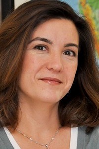
By Derek Alderman
 We are just days away from the start of the AAG annual meeting. I look forward to seeing many of you in New Orleans. For most of us, participating in the conference is work. It may be a labor of love, but it represents, nonetheless, a significant investment in terms of money, energy, and time. Please know that your investment and work on behalf of the discipline and the Association at the meeting is appreciated…No doubt, conferences should be about the work of building disciplinary bonds and expertise; however, I would suggest our meetings potentially offer an even wider array of professional interactions and benefits that open us to new places, people, and skills. In this column, I discuss the value, but also the challenges, of making our AAG meetings more public-oriented.
Continue Reading.
Read past columns from the current AAG President on our President’s Column page.
ANNUAL MEETING
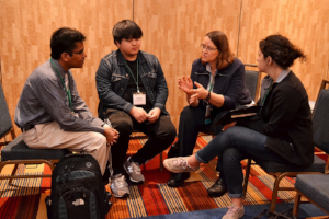
Emerging Workforce Scholars Program at the AAG Jobs and Careers Center
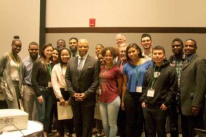
Launched at the 2017 Annual Meeting in Boston, the AAG’s Emerging Workforce Scholars program enables aspirational community college and undergraduate students from underserved New Orleans-area communities to attend the Annual Meeting and interact with geography and geoscience professionals to learn about the work they perform and the preparation required for careers in their field. This year, the AAG is proud to partner with Limitless Vistas, Inc., New Orleans Flood Protection Authority-East, Delgado Community College Workforce Development, University of New Orleans Pontchartrain Institute for Environmental Sciences, and others to make this another successful career exploration program. Plan to attend the program Keynote with Ron Spooner, chief engineer for the New Orleans Sewerage and Water Board (S&WB) and Commander in the U.S. Naval Reserve, and extend a warm welcome to the Emerging Scholars as they explore careers in geography and the geosciences!
See more information about the Emerging Workforce Scholars Program and events.
Go Green by Downloading the AAG Mobile App
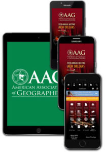 Make the most of your AAG annual meeting experience by downloading the AAG mobile app, the digital version of the AAG Annual Meeting Program. With the AAG mobile app, attendees can browse sessions and abstracts, create and save a personalized schedule of events, and find up to the minute information about room changes or upcoming activities. A detailed user manual is available for download on the AAG Annual Meeting website. Don’t wait until you’re standing in the registration line, download the AAG mobile app before you get to New Orleans!
Get started with the AAG mobile app.
Cheer on your Regional Team at the 2018 World Geography Bowl
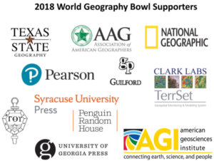 The annual round robin tournament features teams of students from each of the AAG Regional Divisions competing for both a team championship title and individually for an MVP Award. The 2018 World Geography Bowl will be held on Wednesday, April 11 starting at 7:30 PM in the Bayside A-C, Oak Alley, and Nottoway rooms on the 4th Floor of the Sheraton hotel, one floor down from the International Reception. Stop by on your way to the reception or join in to watch the championship round after the reception concludes! Prizes donated from generous sponsors are awarded to winning teams and individuals.
Learn more about the bowl.
Family Activities, Childcare, and Dining in New Orleans
Are you bringing your whole family with you to #AAG2018? The AAG has compiled a list of activities everyone will enjoy throughout the week in the Crescent City, including this walking tour of the area: New Orleans, Unmonumentalized by Brian Marks. Don’t forget, the AAG will also be offering subsidized on site childcare for ages 6 months to 12 years between the hours of 7:00 AM – 8:00 PM on Tuesday; 7:30 AM – 7:30 PM on Wednesday, Thursday, and Friday; and 7:30 AM – 6:00 PM on Saturday during the conference. Want to check out the local food scene? Skeeter Dixon has gathered some dining suggestions for those looking to try out an Oyster Bar, Po Boy, or cocktail.
Find family activities and dining.
Jobs and Careers Center at the 2018 Annual Meeting
 The Jobs and Careers Center will be open daily from 8:00 AM to 5:30 PM daily during #AAG2018. Stop by for over 65 sessions, workshops, and field trips related to careers and professional development. Sessions will cover a broad range of topics, from working as a geographer in the public, private, nonprofit, or academic sector, to networking strategies, to becoming a certified GIS Professional (GISP), to women in leadership roles in geography. Students, be sure to attend the Student Networking Happy Hour on Thursday, April 12 from 3:00 – 5:00 pm.
Full schedule of Jobs and Careers events.

Flood Control Infrastructure and ‘Political Hydrology’ along the LA-TX Gulf Coast
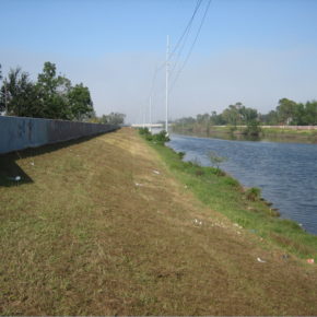 Flooding still represents the costliest natural disasters in the United States on an annual basis, explains Paul F. Hudson of Leiden University. New Orleans, site of the 2018 AAG Annual Meeting, has seen its fair share of flood events, with Hurricane Katrina damages totalling $153.0 billion and Hurricane Harvey disaster-related expenses expected to rise beyond Katrina’s costs. President Obama’s Executive Order 13690 was expected to help decrease the monetary costs associated with flood occurrences, however it was recently overturned. Hudson outlines the goals of EO 13690 and compares action in the United States with recent work in the Netherlands. Annual Meeting.
Continue Reading.
Southwest Louisiana’s Creole Trail Riding Clubs
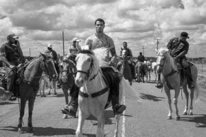 While many outsiders may be familiar with the larger Mardis Gras parades and festivals in Louisiana, fewer people know about the trail riding events of the state’s Creole riding clubs. Alexandra Giancarlo elaborates on the history of Creoles in southwest Louisiana and the cultural trail riding events that continue today, many now as fundraising opportunities for charity events or to help local community members. Look for Giancarlo’s #AAG2018 field trip exploring this topic: Zydeco, Gumbo, and Black Innovators: A Day Trip to Southwestern Louisiana Creole Country.
Read the full story.
New Orleans: Place Portraits
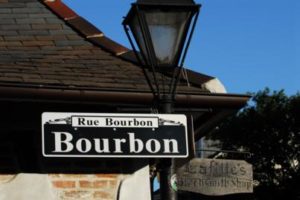 The Big Easy has always been cool, but the geography of cultural strongholds in the city has changed over time. Bourbon Street in the 1930s was a hotbed of nightlife with its 63 nightclub establishments, some of the first in the United States. But is Bourbon Street, with its critics’ claims of inauthenticity, still considered “cool” today? Richard Campanella of the Tulane School of Architecture and New Orleans’ unofficial “geographer laureate” maps out the historical geography of coolness in the Crescent City, ending with a call to see Bourbon Street as post-cool, a “triumph of localism.”
“Focus on New Orleans and the Gulf Coast” is an ongoing series curated by the Local Arrangements Committee to provide insight on and understanding of the geographies of New Orleans, Louisiana, and the greater Gulf Coast region in preparation for the 2018 Annual Meeting.
ASSOCIATION NEWS
2018 AAG Book Awards Announced
 The AAG is pleased to announce the recipients of the three 2018 AAG Book Awards: the John Brinckerhoff Jackson Prize, the AAG Globe Book Award for Public Understanding of Geography, and the AAG Meridian Book Award for Outstanding Scholarly Work in Geography. The AAG Book Awards mark distinguished and outstanding works published by geography authors during the previous year, 2017. Formal recognition of the awardees will occur during the AAG Awards Luncheon at the Annual Meeting on Saturday, April 14, 2018.
See the Awardees.
MEMBER NEWS
Jepson named a 2018-19 AAAS Alan I. Leshner Leadership Institute Public Engagement Fellow
 Wendy Jepson, professor of Geography at Texas A&M University, was named a AAAS Alan I. Leshner Leadership Institute Public Engagement Fellow for the class of 2018-2019. Jepson, who was recently elected an AAG National Councilor, is one of the 15 food and water security researchers chosen to represent this year’s class of fellows. The goals of the Leshner Leadership Institute are not only to address scientific issues surrounding resource availability, but also to better engage the public through science/society dialog.
Read more about Jepson.
Profiles of Professional Geographers
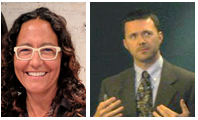 Geographers Cristi Delgado, GISP, Enterprise GIS & Open Data Coordinator for the City of Berkeley, California and Paul McDaniel, Assistant Professor of Geography at Kennesaw State University love the ways that a career in geography connects them with current events and their communities. In this month’s Profiles of Professional Geographers, read about their varied career paths and the diverse skills needed to pursue employment in the geographic field.
Learn more about Geography careers.
IN MEMORIAM
Alfred W. Crosby
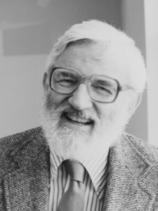 Alfred W. Crosby died peacefully at Nantucket Cottage Hospital among friends and family on March 14, 2018. He was 87 and had lived with Parkinson’s Disease for two decades. During his career, Crosby taught at Albion College, the Ohio State University, Washington State University, and the University of Texas at Austin, retiring in 1999 as Professor Emeritus of Geography, History, and American Studies. In addition to his many accolades, Crosby was also involved in the Civil Rights movement, taught Black Studies and the history of American jazz, helped to build a medical center for the United Farm Workers’ Union, and took a leadership role in anti-war demonstrations.
Read more.
POLICY
Omnibus Appropriations Bill Includes AAG-Supported Increases for Research Agencies

The AAG continues to monitor federal decisions of importance to geography and our members. On March 23, President Trump signed a $1.3 trillion omnibus spending bill that funds the federal government through the end of Fiscal Year 2018 (September 30). The legislation provides increased appropriations for many programs of importance to geographers, listed in the full AAG report of this bill. The AAG has repeatedly supported robust funding for federal science agencies, and we will continue to promote the value of research programs as Congress moves on to consideration of 2019 budgets. Unfortunately, the omnibus does not include a fix for the popular DACA (Deferred Action for Childhood Arrivals) program.
Full report available.
RESOURCES & OPPORTUNITIES
Call for Abstracts: Special Issue of ‘Annals’ on “Smart Spaces and Places”
 The Annals of the American Association of Geographers seeks contributions for a Special Issue on the topic of Smart Spaces and Places. ‘Smart’ technologies have advanced rapidly throughout society (e.g. autonomous vehicles, smart energy, smart health, smart living, smart cities, smart environment, and smart society) and across geographic spaces and places. We welcome theoretical, methodological, and empirical contributions to address questions such as how to make spaces and places ‘smart’, how the ‘smartness’ affects the way we perceive, analyze, and visualize spaces and places, and what role geographies play in knowledge production and decision making in such a ‘smart’ era. Abstracts of no more than 250 words should be submitted by email to Jennifer Cassidento (jcassidento [at] aag [dot] org) by April 30, 2018.
Read the full call.
 Early Career Faculty and Department Leadership Workshops
On behalf of the Geography Faculty Development Alliance, the AAG is pleased to announce the 2018 Early Career and Department Leadership Workshops! These annual workshops for early career faculty and late career graduate students or geography department leaders will be held at the George Washington University in D.C. from June 10-16, 2018 (early career) and June 13-16, 2018 (department leaders).
More information and registration available.
NCRGE Transformative Research in Geography Education Funding
 The National Center for Research in Geography Education (NCRGE) invites proposals to develop new collaborative and interdisciplinary research networks in geography education. Through this program, NCRGE aspires to strengthen geography education research processes and promote the growth of sustainable, and potentially transformative, lines of research. Along this vein, NCRGE is also hosting a series of sessions in Transformative Research in Geography Education at the 2018 AAG Annual Meeting.
Funding proposal deadline May 15, 2018.
PUBLICATIONS
‘Southeastern Geographer’ Special Issues on Geographies of Louisiana and Black Geographies
 In recognition of the location of AAG’s 2018 Annual Meeting in New Orleans and Black Geographies as one of the three meeting themes, Southeastern Geographer offers free access to digital issues on Geographies of Louisiana and Black Geographies. Since its founding in 1962, Southeastern Geographer has often published research on issues before they were the “hot-topics” of today, including racial segregation evident in residential neighborhoods, electoral geographies, Confederate monuments, and long-term weather patterns with implications for climate change. Papers selected from across several decades demonstrate some of the breadth of such work. The digital issues will be available with open access until May 31, 2018. After that, they will be accessible through Project MUSE’s standard subscription.
Browse Geographies of Louisiana or Black Geographies.
May 2018 Issue of the ‘Professional Geographer’ Now Available
 The Professional Geographer, Volume 70, Issue 2, has been published. Of note to geographers interested in the Public Engagement theme for #AAG2018, the focus section in this issue is Out in the World: Geography’s Complex Relationship with Civic Engagement. The issue also includes short articles in academic or applied geography, emphasizing empirical studies and methodologies.
See the newest issue.
New Books in Geography — February 2018 Available

Each month the AAG publishes a list of newly-published books in geography and related fields. Books compiled from the month of February include titles by David Harvey and topics ranging from the 2016 election to GIS and drones to poverty and place.
Browse the whole list of new books.
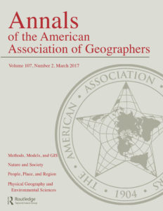
Read the March 2018 Issue of the ‘Annals of the AAG’
Every year since 2009 our flagship journal, the Annals of the American Association of Geographers, has published a special issue that highlights geographic research around a significant global theme. The tenth special issue of the Annals, published in March 2018, brings together 27 articles on the topic of Social Justice and the City, edited by Nik Heynen.
Full article listing available.
Winter 2018 Issue of ‘The AAG Review of Books’ Now Available
 Volume 6, Issue 1 of The AAG Review of Books has now been published online. In this first issue of 2018 be sure to check out the discussions of Concrete Revolution: Large Dams, Cold War Geopolitics, and the US Bureau of Reclamation, Degraded Work: The Struggle at the Bottom of the Labor Market, and Cities in Global Capitalism.
Read the reviews.
FEATURED ARTICLES
Stop Teaching GIS
By David DiBiase
Teach how to learn GIS instead. …
… Since the late 1990s, over 10,000 students have taken [Nature of Geographic Information, part of Penn State’s online GIS programs], and most have expressed satisfaction with their experiences. Penn State colleagues and students helped me update the course incrementally. But the geospatial field has changed fundamentally since the late 1990s, and the Penn State Online program, which the course was designed to introduce, has evolved and expanded along with it. Equally important, our understanding of how people learn (and, in particular, how they learn online) has advanced considerably. Nearly 20 years on, Nature of Geographic Information was overdue for a complete makeover.
Continue reading.
Featured Articles is a special section of the AAG Newsletter where AAG sponsors highlight recent programs and activities of significance to geographers and members of the AAG. To sponsor the AAG and submit an article, please contact Oscar Larson olarson [at] aag [dot] org.
GEOGRAPHERS IN THE NEWS
IN THE NEWS
Popular stories from the AAG SmartBrief
EVENTS CALENDAR
Submit News to the AAG Newsletter. To share your news, email us!

 Dr. Stephen Hanna recently joined the AAG Journals’ editorial team as the Cartography Editor for the AAG suite of journals: the Annals of the Association of American Geographers, the Professional Geographer, and GeoHumanities.
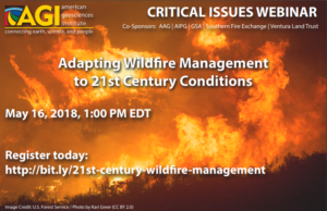 The American Geosciences Institute’s Critical Issues Program is pleased to offer a free webinar in partnership with the American Association of Geographers, “
 What was your favorite class in K-12? Oceanography (I grew up on an island in a fishing family, it was the perfect combination of personal experience and science) and, yes, it absolutely incorporated geography.